When you click on links to various merchants on this site and make a purchase, this can result in this site earning a commission. Affiliate programs and affiliations include, but are not limited to, the eBay Partner Network.
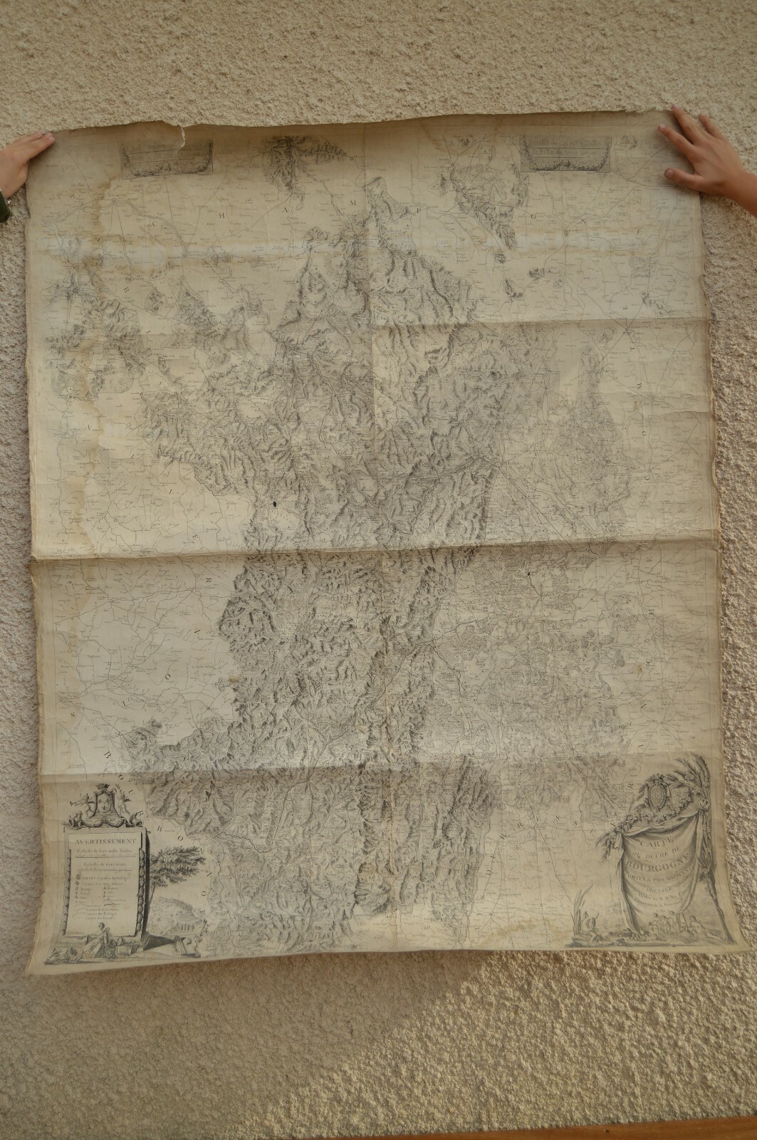
Map of:DuchédeBourgogneComtés et Pays adjacentsdresséepar Ordre de M.M. les ElusGénéraux de la Province 1782.
Scale of eight thousand toises (1: 180,000)
Designed by François Pourcher Engineer
Under the direction of Emiland Marie Gauthey ChiefEngineer
J Monnier, engraver.
Divione Sculthorn
Wall card format: Height: 126 Cms, Width: 100 Cms.
The details are numerous and incredible, all cities,villages and castles are represented. The reliefs and massive woods are verywell rendered and allow to better imagine the topography.
An example of this map appears on OCLC and onGeographicus. Another in color has been sold on geographical and three copiesare compared to the National Library of France: FRBNF40639227, FRBNF40639228and FRBNF40639229.
The state of the map is good. It is made of thickpaper, but does not have the fabrics to be folded, but the folds are clearlyvisible, and the card has remained rolled since many years.
The map is a little torn in the upper left on about 8Cms. The borders are chipped, the traces of freckles are visible. Wettings aredisplayed on the left side and on a halo of 6 Cms at the top.
Cartedu DuchédeBourgogne
Comtés et Pays adjacentsdresséepar Ordre de M.M. lesElusGénéraux de la Province en1782.
Echelle de huit mille toises(1 : 180000)
Dessinée parFrançois PourcherIngénieurSous la direction d’EmilandMarie GautheyIngénieur en chefJ Monnier, graveur.Divione Sculptheur
Carte murale format:Hauteur:126 Cms, Largeur: 100 Cms.
Les détails sont nombreux etincroyables, toutes les villes, villages et châteaux, sont représentés. Les reliefs etmassifs boisés sont très bien rendus et permettent de mieux imaginer latopographie.
Un exemple de cette carte apparaît sur OCLC et unautresur geographicus. Un autre en couleur aétévendusur geographicus et trois exemplaires sont répertoriésàlaBibliothèque Nationale de France: FRBNF40639227, FRBNF40639228 etFRBNF40639229.
L’état de la carte est bon. Elle est faite enpapierépais et ne comporte pas de support tissus pourêtre pliée,maisdes trames de pliures sont bien visibles, cependant la carte estrestée roulée depuis de nombreuses années.
La carte est un peu déchirée dans lehautàgauche sur environ 8 Cms. Les bordures sont ecornées, destraces de rousseurs sont visibles. Des mouillures sont présentes le long ducotégauche et sur une auréole de 6 Cms en haut.