When you click on links to various merchants on this site and make a purchase, this can result in this site earning a commission. Affiliate programs and affiliations include, but are not limited to, the eBay Partner Network.
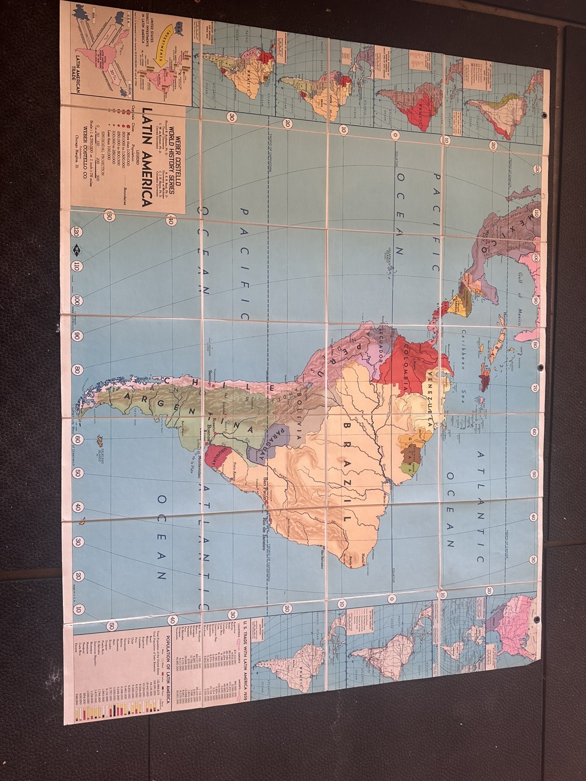
Vintage Weber Costello World History Series map of Latin America. Classroom map from Chicago Heights, Illinois. Same folding cloth-backed school format as the Reality Series sheets, different series: World History Series, not Reality Series.
Cloth / fabric-backed folding sheet, not a loose paper poster and not a roller pull-down. Paper map mounted on fabric so it can fold, hang, and hold together at the creases. Opens to wall size; folds along the printed grid into a compact packet. Hanging holes along the top edge.
What it shows
Mexico, Central America, the Caribbean, and South America, with inset world and regional panels. Color-coded countries. City population legend. Side and bottom teaching panels: Latin American trade diagram, U.S. trade with Latin America 1950, population of Latin America 1950, and related history / commerce callouts.
Date
Printed data is dated 1950 (population table and U.S. trade with Latin America 1950). Best estimate circa 1950–1952.
Title block
WEBER COSTELLO
WORLD HISTORY SERIES
LATIN AMERICA
Weber Costello Co.
Chicago Heights, Ill.
Scale 1:14,750,000 or 1 inch = 233 miles
Condition
Used vintage cloth-backed school map. Original fold grid. Colors still readable in photos. Expect typical age: crease wear, edge wear, light soiling, possible small splits or stains at folds. Hanging holes at top. Please use the photos as part of the description. Sold as-is.
Shipping
Ships folded in a rigid mailer or small box so the folds don’t get crushed. Combined shipping if you take more than one map.
Questions welcome. Smoke-free home.