When you click on links to various merchants on this site and make a purchase, this can result in this site earning a commission. Affiliate programs and affiliations include, but are not limited to, the eBay Partner Network.
97.5 x 38.5 cm (38.4 x 15.15 in.).
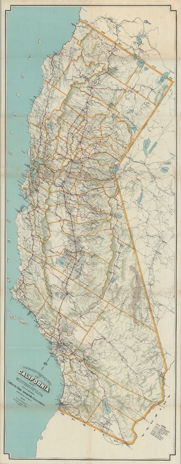
This California state road map from the year 1917 provides an excellent overview of the state’s highway network. During this era, car travel was becoming increasingly popular, and a growing network of roads spread across the state. The map was published by the California State Automobile Association (CSAA), which played a vital role in advocating for improved roads, promoting tourism, and providing resources to motorists. They published maps and guides, helping drivers navigate the state’s highways.
The map offers valuable insights into the state’s highway network, including major early interstate highways and other state-designated routes. It also shows the locations of towns and cities, which serve as reference points along the highways, along with features of California’s topography and geography, such as rivers, mountains, deserts, and other notable natural landmarks that could help orient travelers.Context is everything
In the late 1910s, California’s road system was still in its early stages of development, reflecting the state’s growing need for efficient transportation infrastructure. While the network was far from its modern-day scale and complexity, significant strides were being made to connect various regions and facilitate commerce, tourism, and personal travel.
California’s highway network in 1917 consisted primarily of a combination of paved and unpaved roads, many of which followed existing routes established during the Spanish and Mexican eras. The state was experiencing rapid population growth, prompting a need for improved transportation links between urban centers and rural areas.