When you click on links to various merchants on this site and make a purchase, this can result in this site earning a commission. Affiliate programs and affiliations include, but are not limited to, the eBay Partner Network.
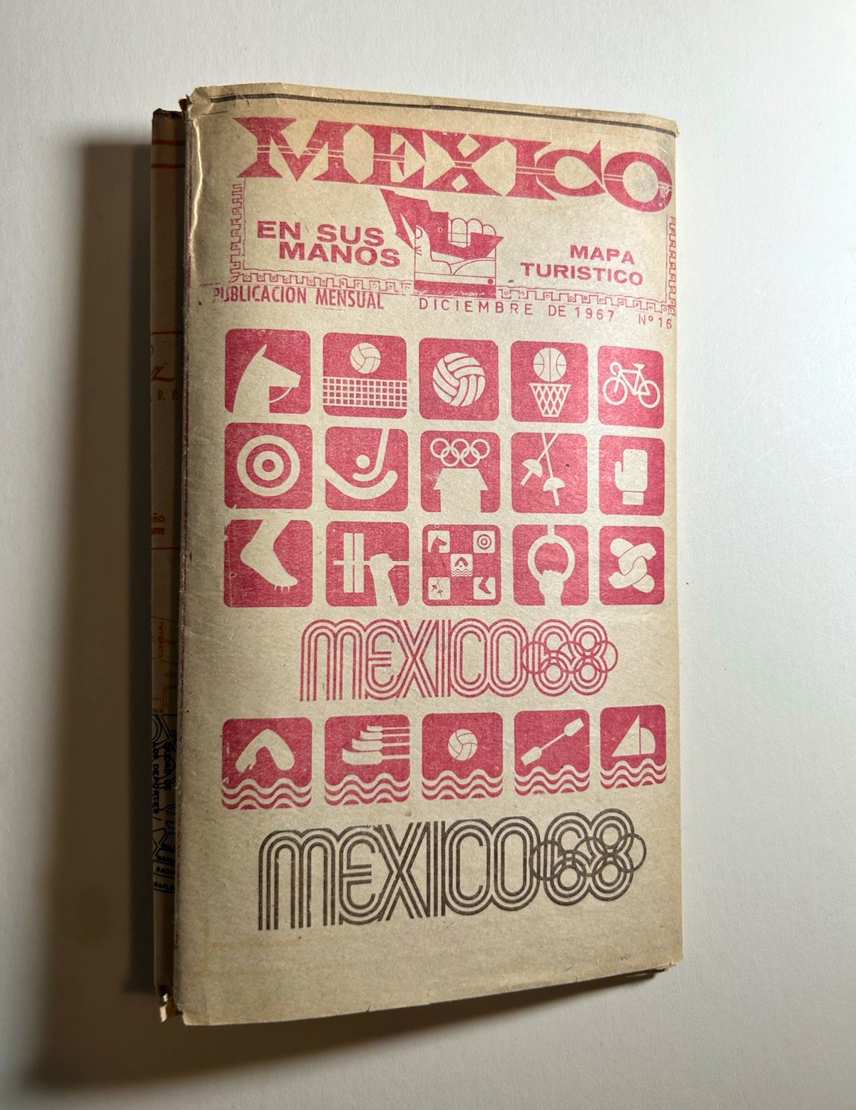
Original 1967 México en sus manos Folding Tourist Map – Mexico 1968 OlympicsOriginal vintage folding tourist map published in Mexico in December 1967, immediately preceding the 1968 Mexico City Summer Olympic Games.Published as No. 16 of México en sus manos, this large-format, double-sided folding map features the iconic Mexico 68 Olympic visual identity, including striking red sporting pictograms and geometric typography associated with the celebrated Olympic graphic design program.Features:* Original December 1967 publication, No. 16.
* Large, double-sided folding map.
* Detailed Mexico City street map with major landmarks, attractions, and Olympic venues.
* National map of Mexico with transportation routes and tourist information.
* Schedule of Olympic sporting events.
* Numerous original advertisements for hotels, airlines, restaurants, bus companies, and other businesses.
* Mexico 68 Olympic logos and sporting pictograms.
* Printed by Litográfica Zacatecana, Mexico City.The Mexico 1968 Olympic visual identity, developed by a design team including Lance Wyman, remains one of the most influential achievements in twentieth-century graphic design.This original period publication is an interesting example of the application of Mexico 68 imagery to contemporary tourist cartography and advertising.Condition: Original vintage condition with fold lines, age toning, edge wear, and small tears. Please examine photographs carefully.