When you click on links to various merchants on this site and make a purchase, this can result in this site earning a commission. Affiliate programs and affiliations include, but are not limited to, the eBay Partner Network.
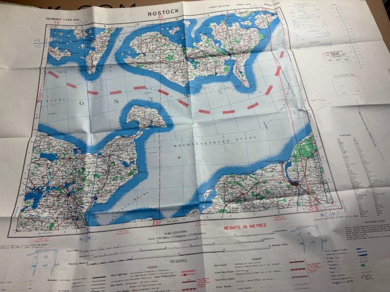
I have some maps to sell covering ; Europe , Africa, The Far East , Australia , New Zealand, The Caribean , Canada , Iceland , The Middle East and Soviet Russia.Get in touch and let me know the area or type of map you want and I will check.I also have a few WWI & WWII maps including some interesting and rare Luftwaffe items.Germany WWII Map Sheet L 1:250,000 Army/Air War Office 1943This is a genuine World War II era map sheet, designated as L, from the Geographical Section, General Staff. Published by the War Office in 1943, this First Edition map covers an area of Germany at a scale of 1:250,000.Key Features:Scale: 1:250,000 (1 Inch = 3.95 Miles; 1 Centimetre = 2.5 Kilometres)Sheet Designation: LEdition: First EditionSeries: Army/AirPublisher: War Office, Geographical Section, General StaffPublication Year: 1943Area Covered: Includes regions around Grid System: Features grid references for navigation.Reference Key: Includes symbols for motor highways, main roads, and other features.Condition:This map is in good used condition. It shows signs of age and handling, including creases and some minor discolouration, which are typical for an item of this age. The map remains fully legible and intact, making it a valuable piece for collectors or historical enthusiasts. Rostock Germany WWII Map GSGS Sheet 1:250,000 Army/Air War Office 1944 Rostock Germany WWII Map GSGS Sheet 1:250,000 Army/Air War Office 1944
Click image to enlarge
Description I have some maps to sell covering ; Europe , Africa, The Far East , Australia , New Zealand, The Caribean , Canada , Iceland , The Middle East and Soviet Russia.
Get in touch and let me know the area or type of map you want and I will check.
I also have a few WWI & WWII maps including some interesting and rare Luftwaffe items.
Germany WWII Map Sheet L 1:250,000 Army/Air War Office 1944
This is a genuine World War II era map sheet, designated as L, from the Geographical Section, General Staff. Published by the War Office in 1944, this First Edition map covers an area of Germany at a scale of 1:250,000.
Key Features:
Scale: 1:250,000 (1 Inch = 3.95 Miles; 1 Centimetre = 2.5 Kilometres)
Sheet Designation: M55
Edition: First Edition
Series: Army/Air
Publisher: War Office, Geographical Section, General Staff
Publication Year: 1944
Area Covered: Includes regions around
Grid System: Features grid references for navigation.
Reference Key: Includes symbols for motor highways, main roads, and other features.
Condition:
This map is in good used condition. It shows signs of age and handling, including creases and some minor discolouration, which are typical for an item of this age. The map remains fully legible and intact, making it a valuable piece for collectors or historical enthusiasts. Payment Mangaed via Shipping Royal Mail Tracked 48hr Terms of Sale Private seller About Us Private seller Contact Us via Get images that
make Supersized seem small.Showcase your items with Auctiva's
Listing Templates!
THE simple solution for sellers.
Track Page Views With
Auctiva's Counter