Vintage 1945 Ashburn's Map of the United States & All Victorious War History For Sale
When you click on links to various merchants on this site and make a purchase, this can result in this site earning a commission. Affiliate programs and affiliations include, but are not limited to, the eBay Partner Network.
Vintage 1945 Ashburn's Map of the United States & All Victorious War History: $64.00
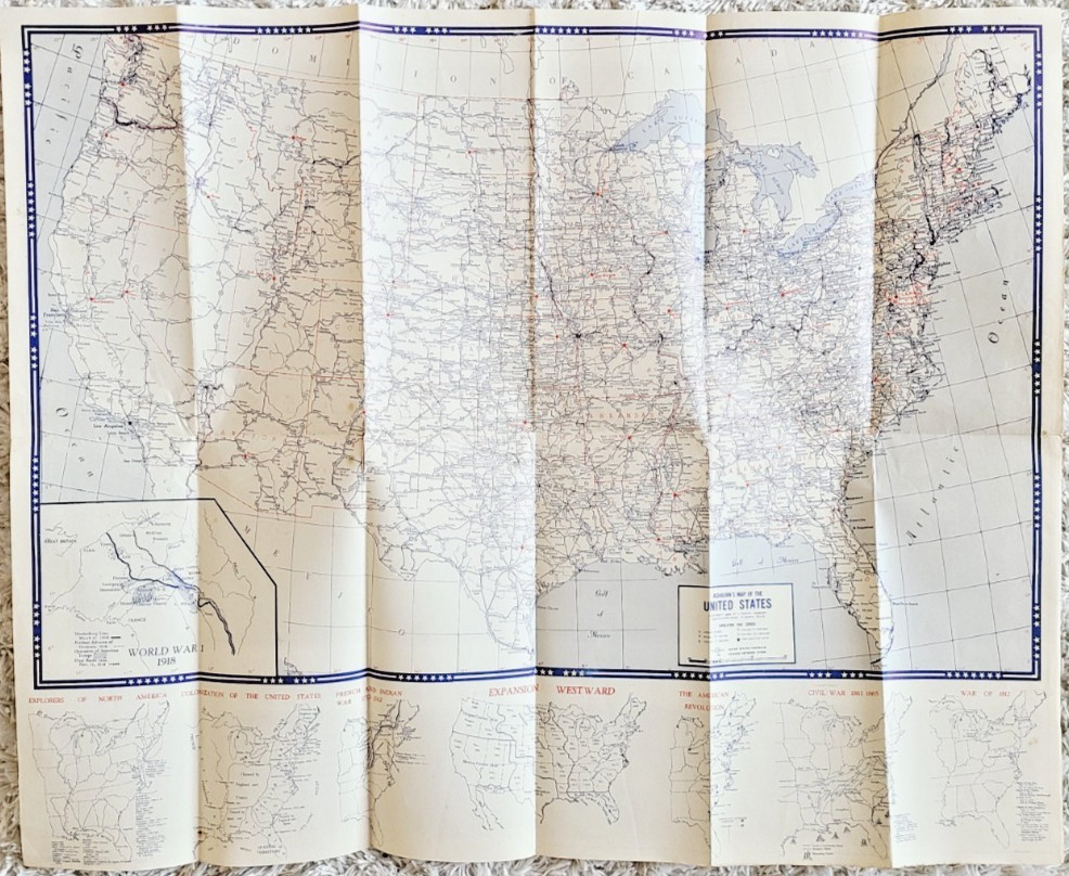
Up for your consideration this vintage, extremely rare and original 1945 Ashburn's Map of the United States - Battles Fought in All Our Victorious War History, in very good condition for the age. Seems just one hole wore through the middle of New Mexico. Size of the map is 19" X 23". One side features:
Large 15" X 23" 1945 map of United States of America
World War I 1918 map in the bottom left corner of it with highlighted Operation of American Troops
Under the U.S. map from left to right shown following maps: Explorers of North America
Colonization of United States
French and Indian War 1752-1762
Expansion Westward
The American Revolution
Civil War 1861-1865
War of 1812
Another side features:
Map of Spanish American War 1898
U.S. Index, and various World War II maps
Map of Pre-war Europe
Map of Pre-war Germany
Map of Japan
Map of China
Map of Formosa (Taiwan)
Map of East Asia
J. Foster Ashburn was a prolific Texas-based cartographer and mapmaker known for creating detailed, distinctively designed maps of Texas cities - including Fort Worth, Dallas, and Houston - as well as other cities throughout the South and Midwest during the 1940s and 1950s. He lived in Fort Worth and published via Ashburn Maps.Please check out all of the pictures and thank you for watching.